At 5:04 p.m. on October 17, 1989, a magnitude 6.9 earthquake struck the Santa Cruz Mountains. Across the Bay Area, familiar routes suddenly stopped working. Part of the Bay Bridge fell onto the roadway below. In Oakland, the upper deck of the Cypress freeway collapsed onto the lower one. In San Francisco and Santa Cruz, buildings failed far from the fault itself.
The earthquake killed 63 people. Forty-two died in the Cypress collapse. Those numbers describe the scale of the loss, but the photographs show how unevenly the damage was distributed: a failed column, a missing span, a building whose upper floor has dropped to street level. Soil conditions and structural weaknesses helped determine what survived.
These USGS images move from the region’s transportation network to its neighborhoods and downtown streets. They were made during the aftermath of the October 17 earthquake; where the archive records only a year or month, that is the date used here.
Topic: Loma Prieta earthquake; disaster history; earthquake engineering
01 / 04
Where the Upper Deck Came Down
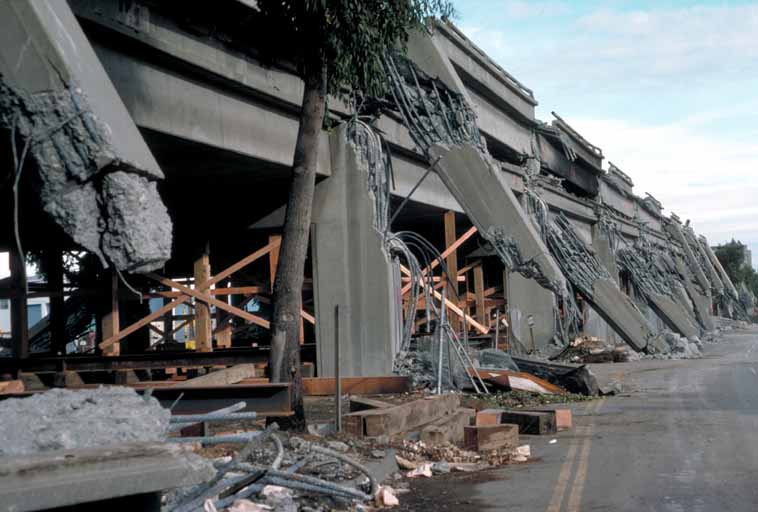
Broken concrete hangs around the exposed reinforcing steel of a Cypress Viaduct support. Behind it, the upper roadway has fallen into the space once occupied by traffic on the lower level. The double-deck freeway ran through West Oakland; its collapse killed 42 people. This USGS view concentrates on the failed structure rather than the rescue operation. Timber bracing beneath the damaged deck marks the work of securing what remained.
Photo details
Date
October 1989, after the October 17 earthquake
Location
Cypress Viaduct, West Oakland, California
Photographer / artist
U.S. Geological Survey; individual photographer not identified
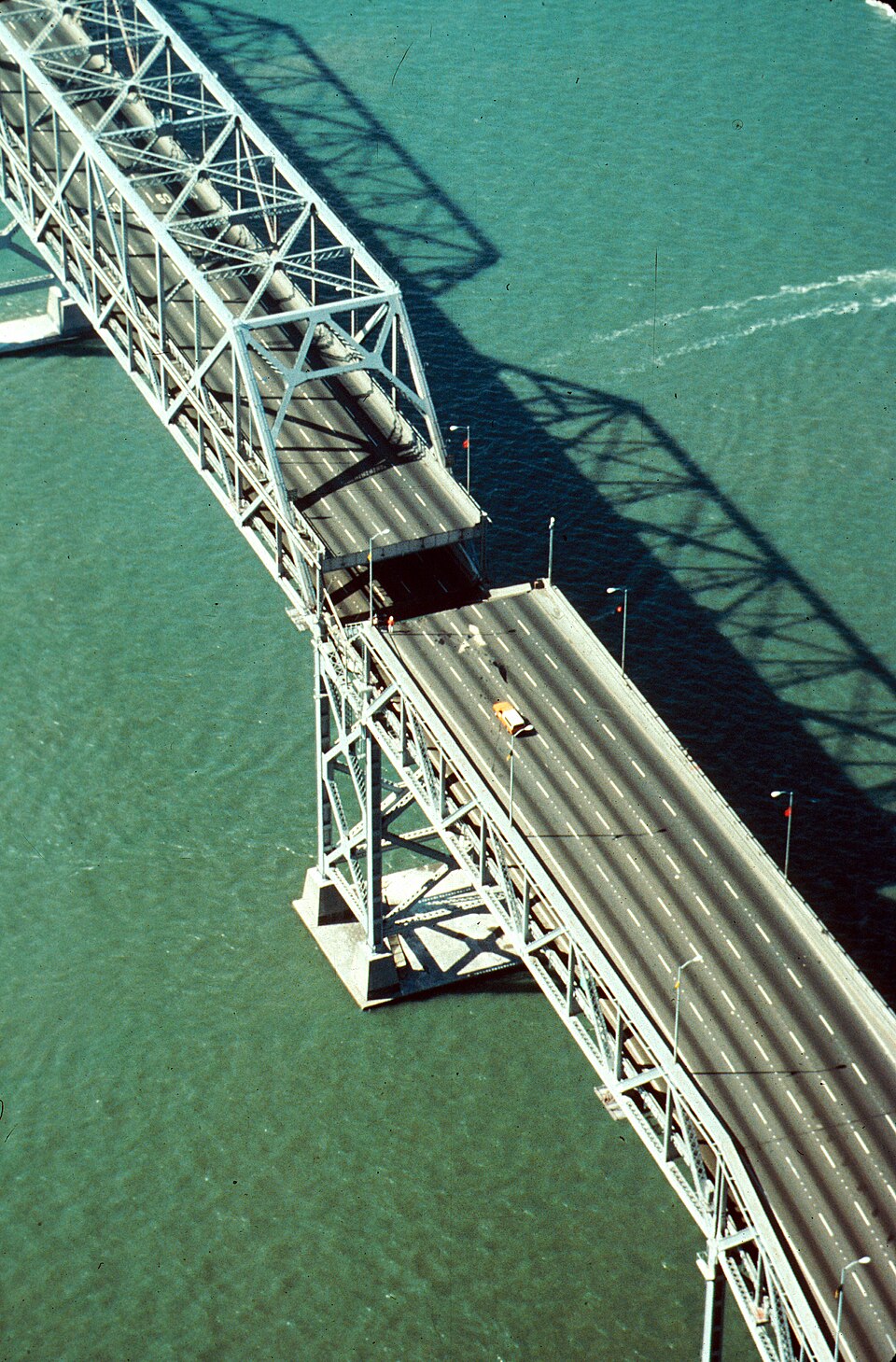
From above, the break looks small against the length of the bridge. At road level it was impassable: part of the upper deck had dropped onto the lower roadway. C. E. Meyer photographed the damaged eastern span looking west. The sharply defined bridge shadow stretches across the water beside it, while the interrupted lanes show how a localized structural failure could sever one of the Bay Area’s principal crossings.
Photo details
Date
October 1989, after the October 17 earthquake
Location
San Francisco–Oakland Bay Bridge, California
Photographer / artist
C. E. Meyer, U.S. Geological Survey
Archive / collection
USGS Open-File Report 90-547, slide II-2
Rights / license
Public domain U.S. Geological Survey photograph; status documented on the linked file record.
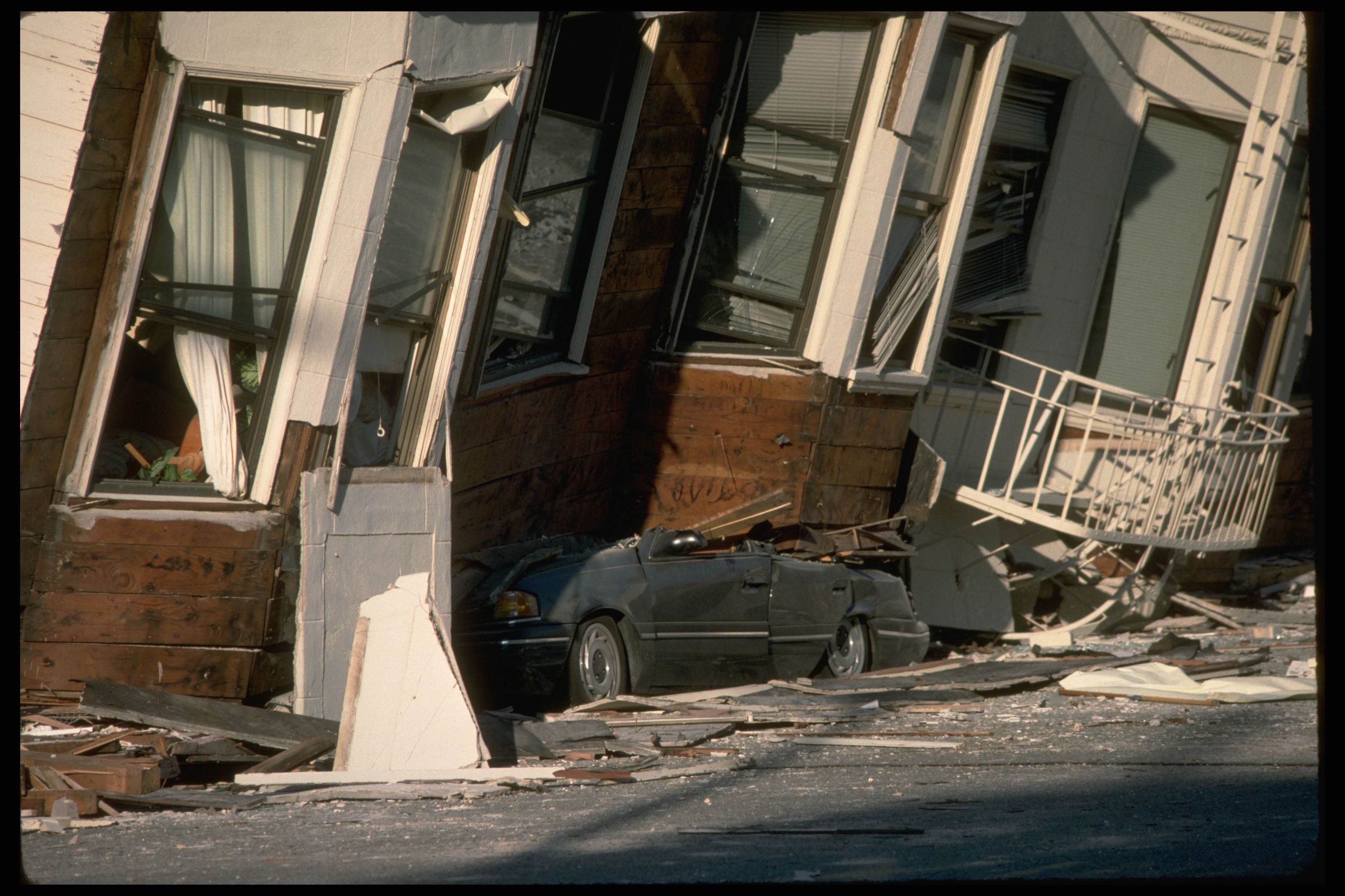
A car is pinned beneath a house whose bay windows now sit close to the pavement. In San Francisco’s Marina District, shaking combined with weak ground and vulnerable buildings to produce severe damage. The USGS identifies this scene as a structural failure involving liquefaction. The building’s recognizable domestic details make the displacement easy to read: windows and a front entrance survive, but the floors that once held them above the street have failed.
Photo details
Date
1989, after the October 17 earthquake; exact day not recorded
Location
Marina District, San Francisco, California
Photographer / artist
U.S. Geological Survey; individual photographer not specified
Archive / collection
USGS Data Series 29, Loma Prieta earthquake photographs
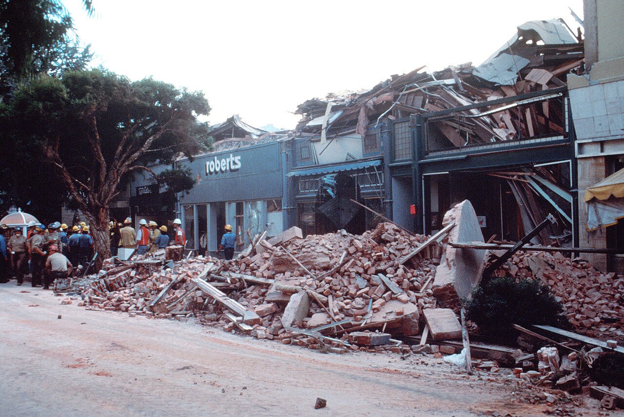
People gather at the edge of the rubble in Santa Cruz’s Pacific Garden Mall, where broken masonry has spilled across the sidewalk. The surviving shopfronts give the destruction an ordinary address: this was a downtown shopping street. C. E. Meyer’s photograph records rescue efforts after the earthquake. Santa Cruz lay much closer to the epicentral area than San Francisco, and its damaged commercial center belongs in the story alongside the better-known bridge and freeway collapses.
Photo details
Date
1989, after the October 17 earthquake; exact day not recorded
Location
Pacific Garden Mall, Santa Cruz, California
Photographer / artist
C. E. Meyer, U.S. Geological Survey
Archive / collection
USGS Open-File Report 90-547, slide XIII-4
Rights / license
Public domain U.S. Geological Survey photograph; status documented on the linked file record.