Canadian troops captured Passchendaele village on November 6, 1917, and fought on along the ridge. This gallery begins with an October planning map, then moves through photographs from the battle’s final period. The archive dates most images to November; none is presented as a photograph of the exact moment of capture.
Topic: First World War
01 / 06
Objectives on paper
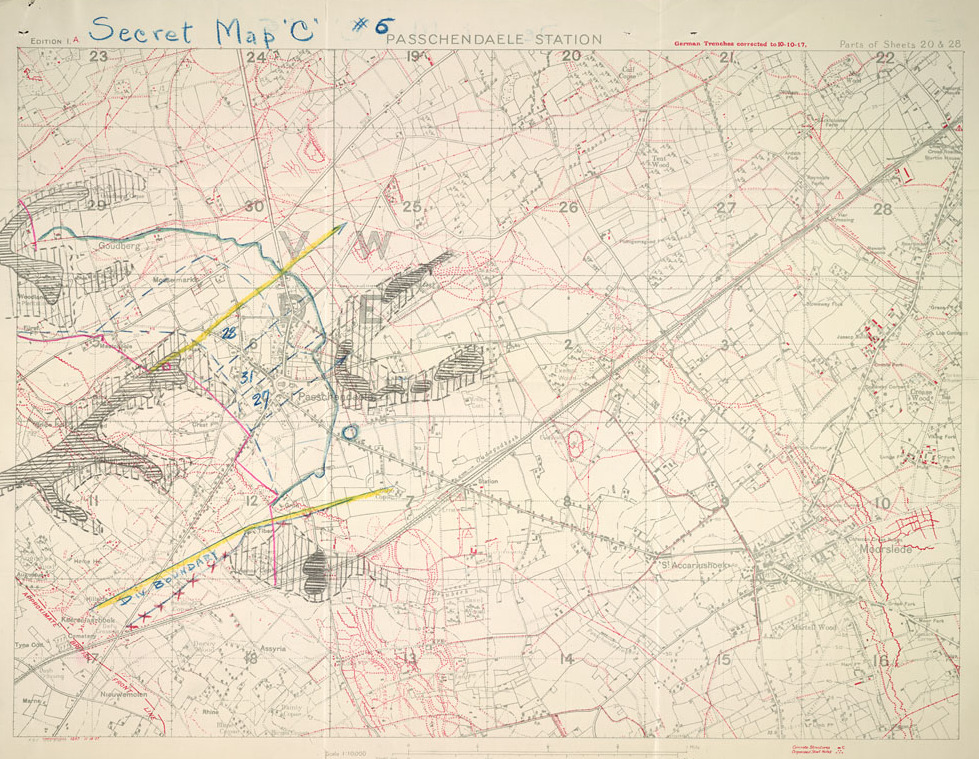
This October 1917 planning map records revised boundaries and objectives for the 6th Canadian Infantry Brigade in the Passchendaele operation. It was prepared at a scale of 1:10,000. Roads, railway lines and unit boundaries offered a framework for organizing an advance across ground that rain and bombardment had made extraordinarily difficult.
Photo details
Date
October 1917
Location
Passchendaele sector, Belgium
Photographer
War Office, General Staff, Geographical Section; Field Service Battalion, Royal Engineers
Library and Archives Canada, 80103-51 CA; MIKAN 3706069
02 / 06
The ground the men crossed
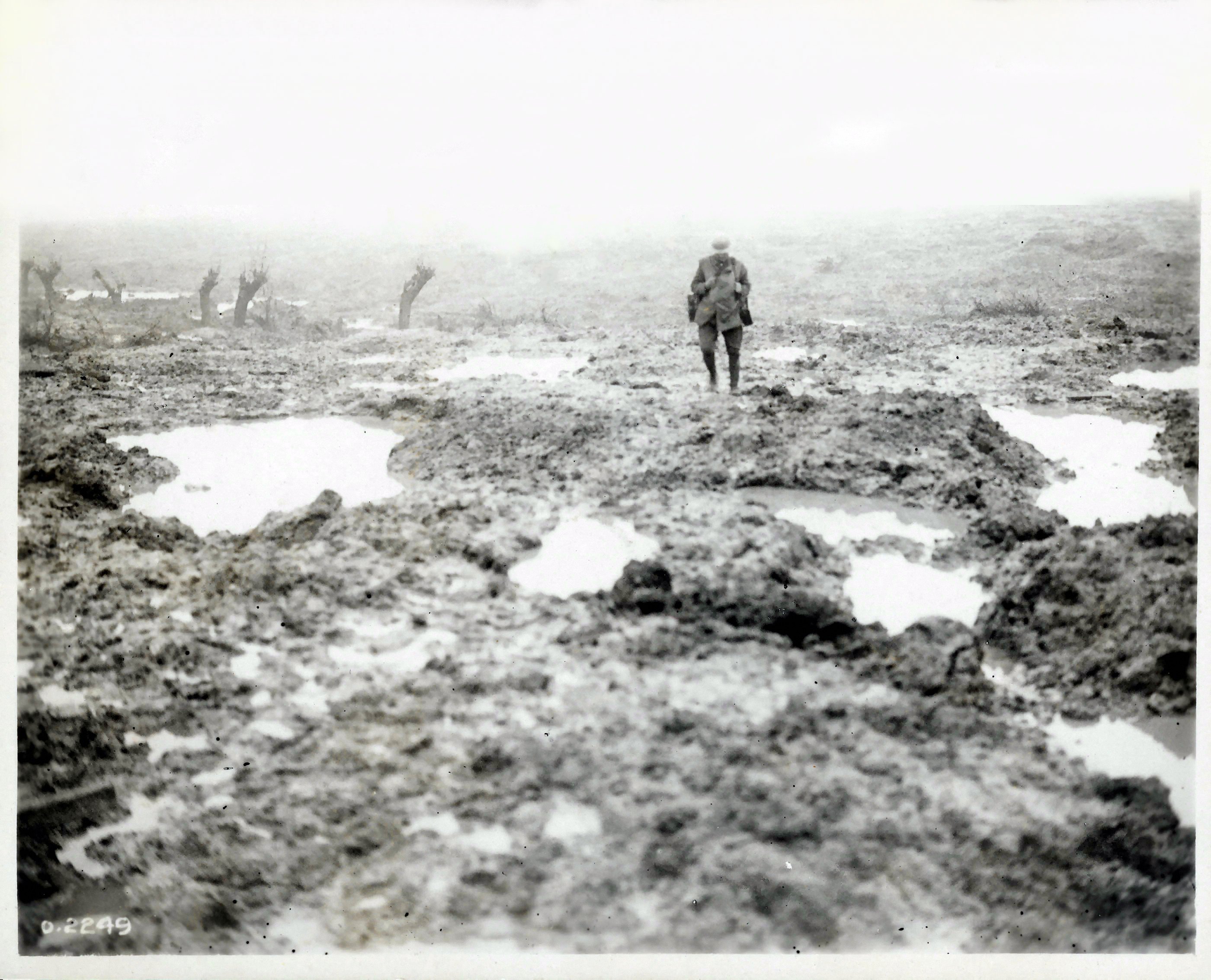
William Rider-Rider photographed mud and barbed wire on the Passchendaele battlefield in November 1917. Pools of water occupy the shell-torn surface. This was the terrain through which Canadian infantry moved and their supporting services had to operate. The record gives the month, rather than a date for the photograph.
Photo details
Date
November 1917
Location
Passchendaele, Belgium
Photographer
William Rider-Rider, Canadian official photographer
Library and Archives Canada, PA-002165; MIKAN 3194807
03 / 06
Finding a route
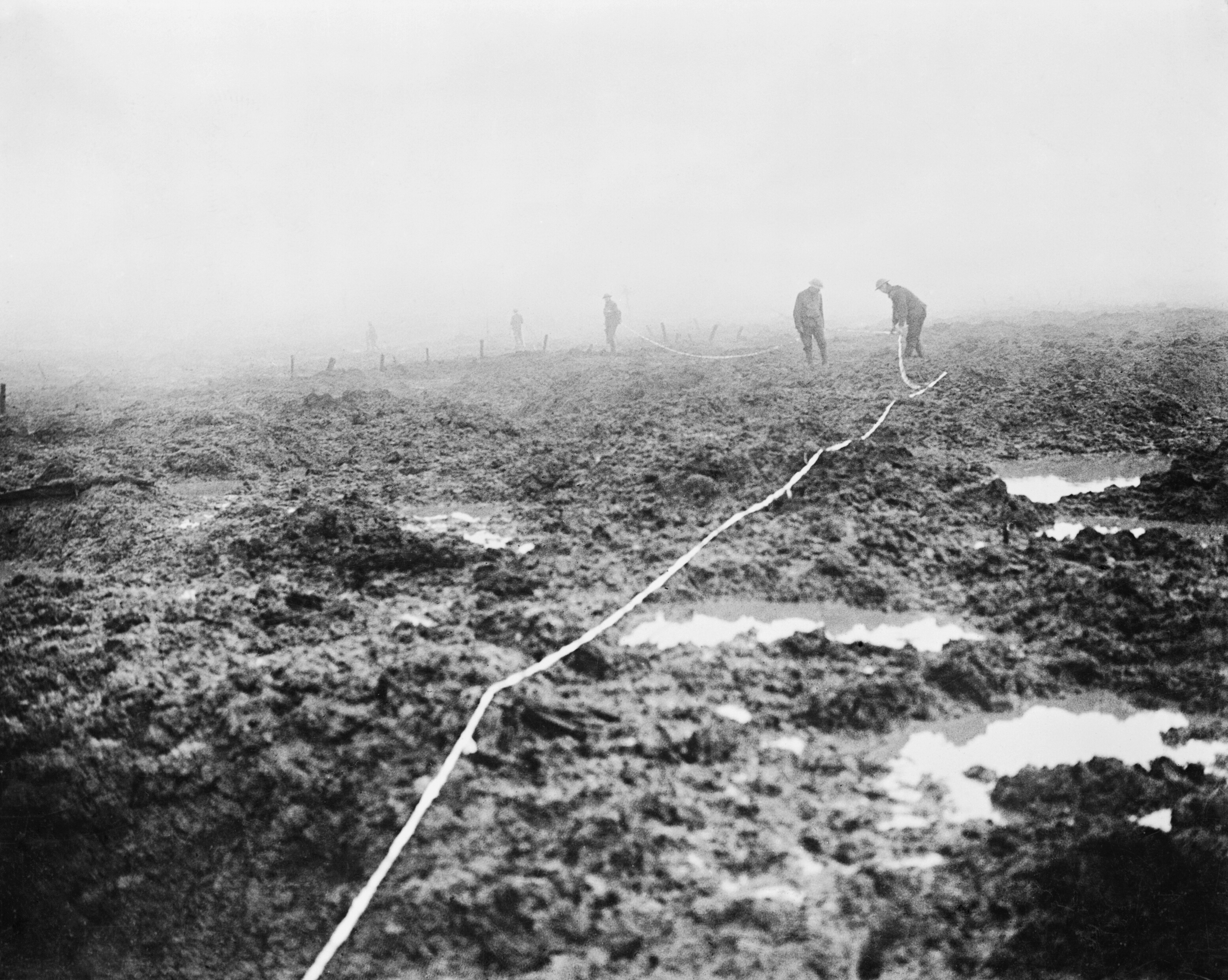
Canadian pioneers lay tape to mark a road through the mud near Passchendaele. The photograph is dated November 1917, during the final period of the offensive. Keeping a usable route across the battlefield required labor as well as planning; guns, supplies, reinforcements and wounded men depended on those connections.
Photo details
Date
November 1917
Location
Passchendaele sector, Belgium
Photographer
William Rider-Rider, Canadian official photographer
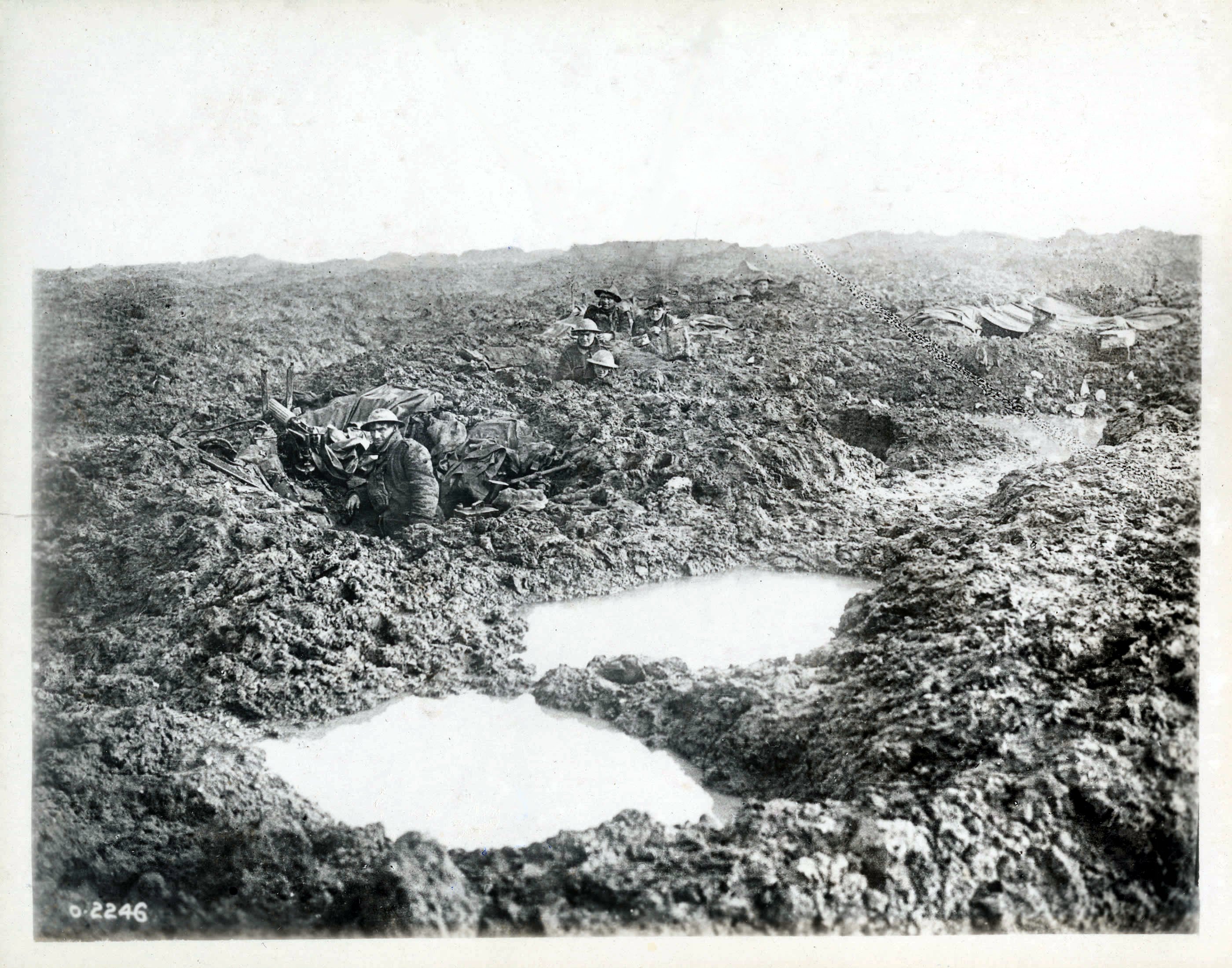
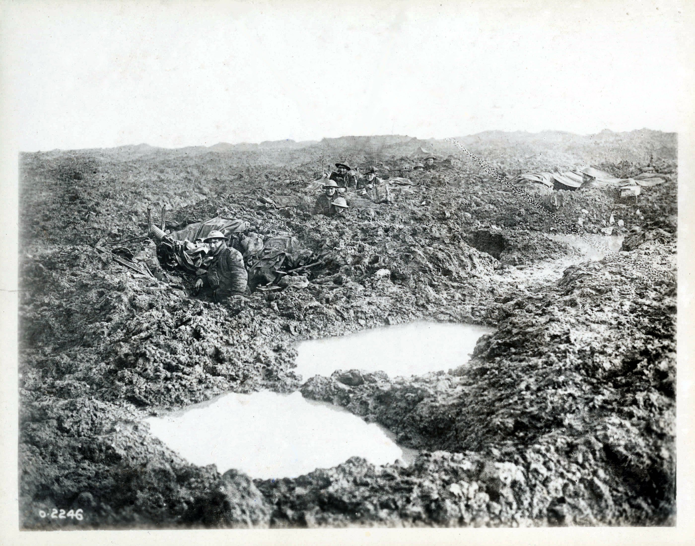
Members of the 16th Canadian Machine Gun Company occupy shell holes at Passchendaele. The Library and Archives Canada record dates the view to November 1917. Low positions offered some cover in a shattered landscape, but water and mud were constant companions. The men are holding ground after the labor of reaching it.
Photo details
Date
November 1917
Location
Passchendaele, Belgium
Photographer
William Rider-Rider, Canadian official photographer
Library and Archives Canada, PA-002162; MIKAN 3233069
05 / 06
Traffic in both directions
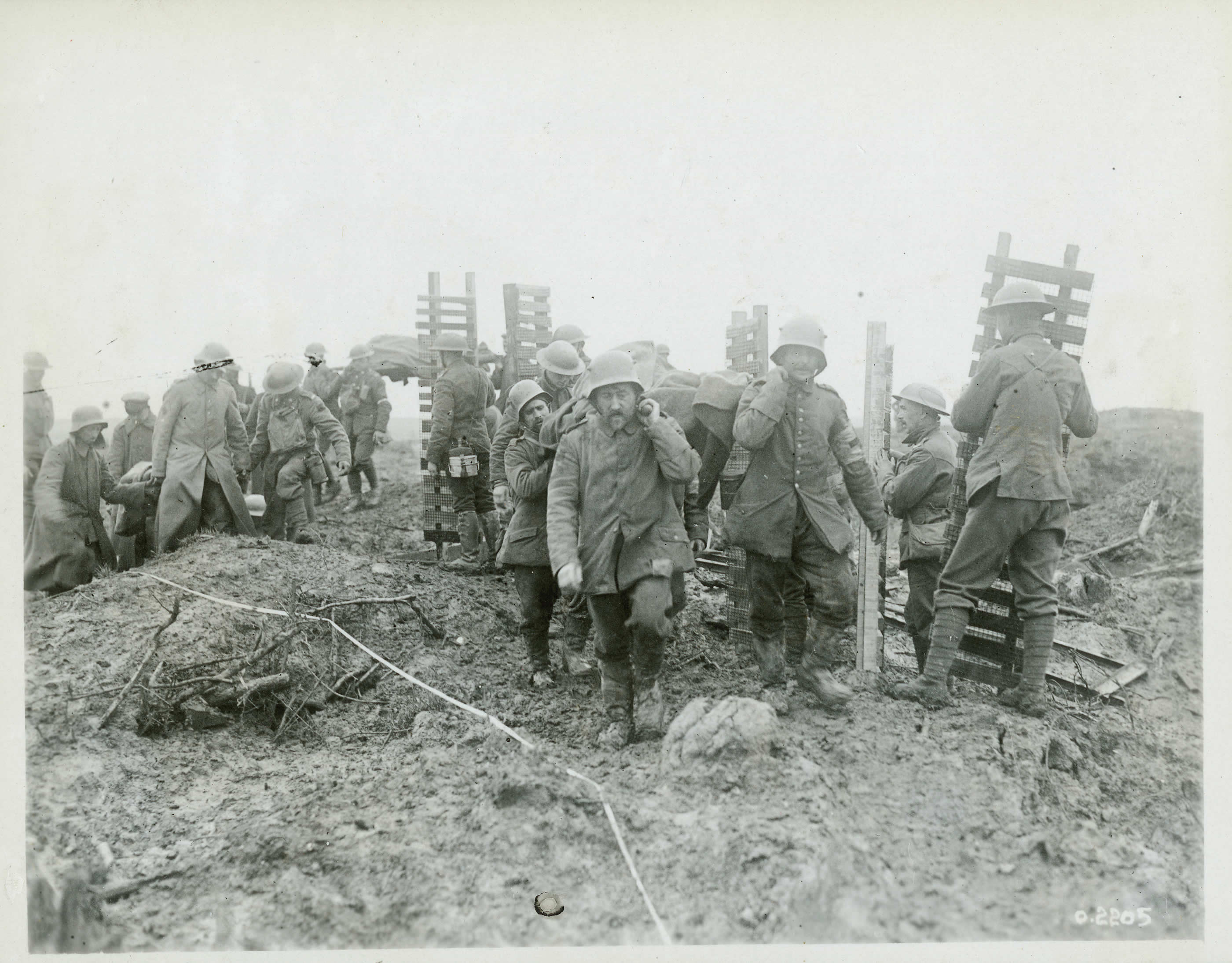
German prisoners help carry wounded Canadians away from the front while Canadian pioneers bring wooden trench mats forward. The photograph records opposing flows of traffic along the same restricted route in November 1917. Material needed for further movement passed men who had already been injured in the fighting.
Library and Archives Canada, PA-002105; MIKAN 3522033
06 / 06
Toward an aid post
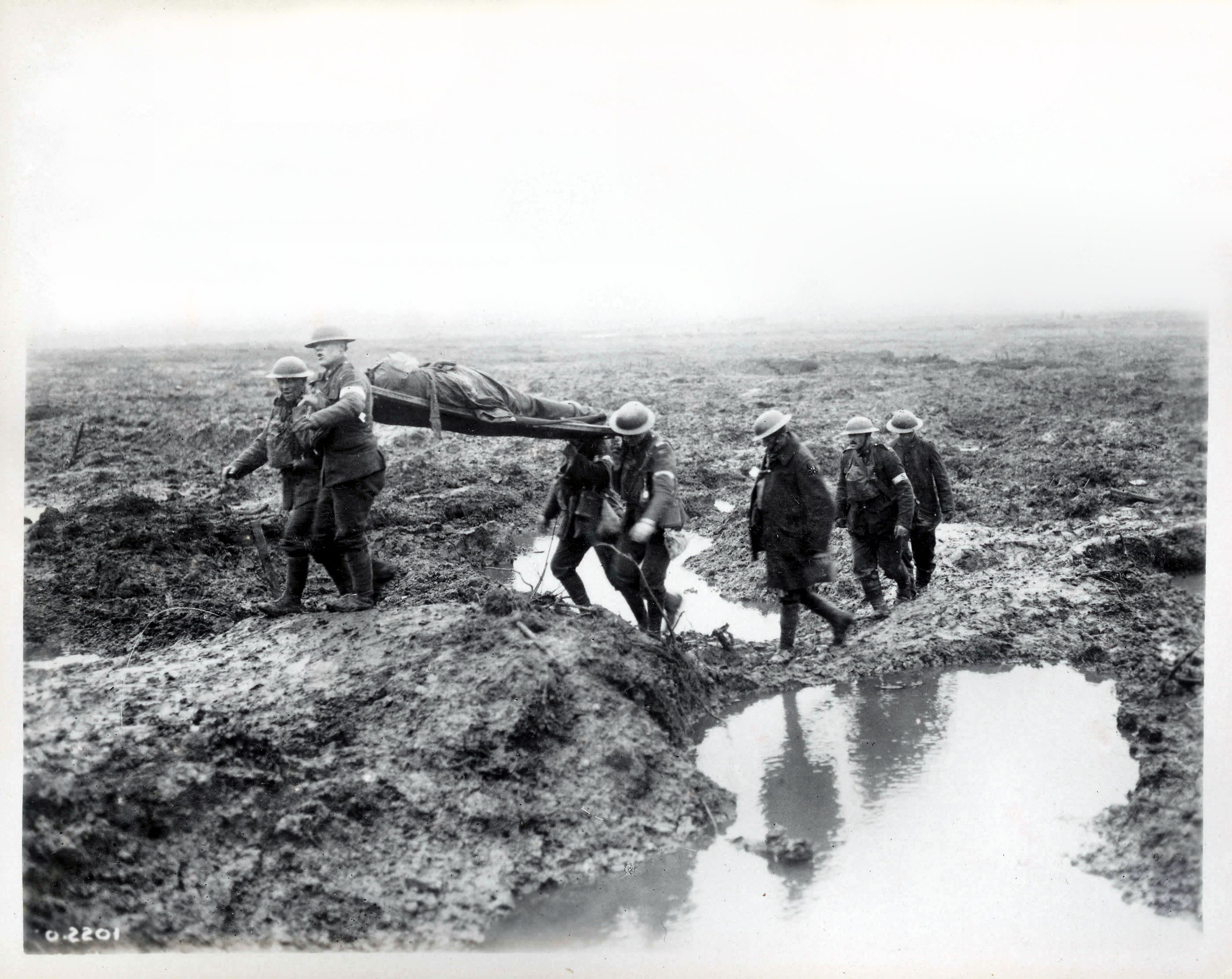
Wounded Canadians make their way toward an aid post during the Battle of Passchendaele. William Rider-Rider’s photograph is dated 1917 in this file record, without an exact day. The men’s clothing and movement carry the battlefield into the evacuation route, extending the story beyond the moment an objective changed hands.
Photo details
Date
1917, during the Battle of Passchendaele; exact day unrecorded
Location
Passchendaele sector, Belgium
Photographer
William Rider-Rider, Canadian official photographer