A cable-spinning ceremony, an optimistic program cover and a crowded opening day precede the familiar collapse image. These six records all depict 1940, although the HAER copy was assembled later. Their dates distinguish the bridge’s short working life from its final morning.
Topic: Tacoma Narrows Bridge collapse
01 / 06
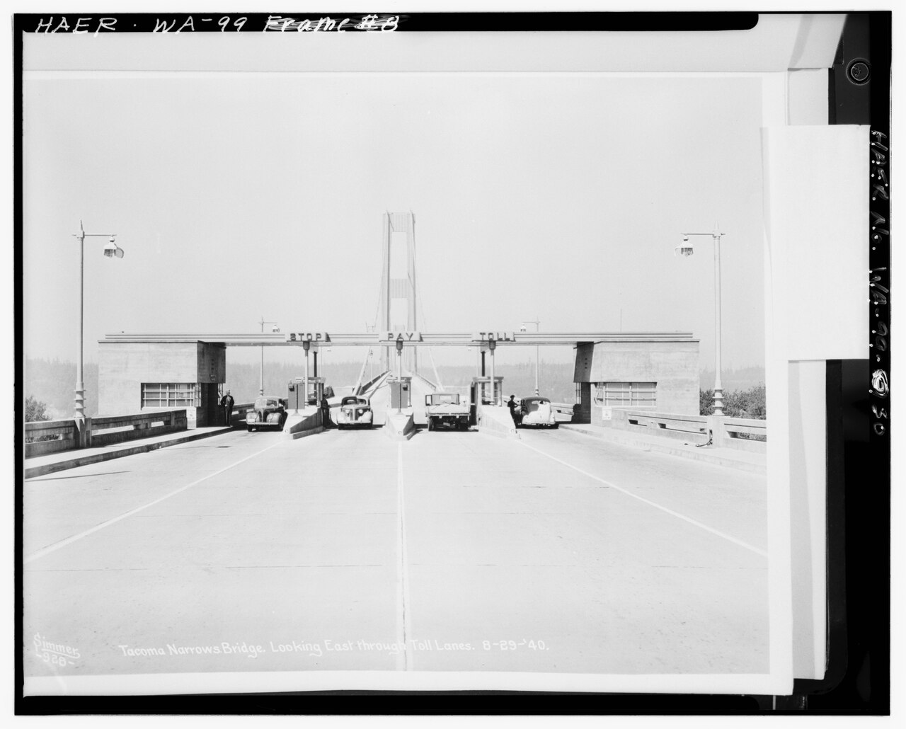
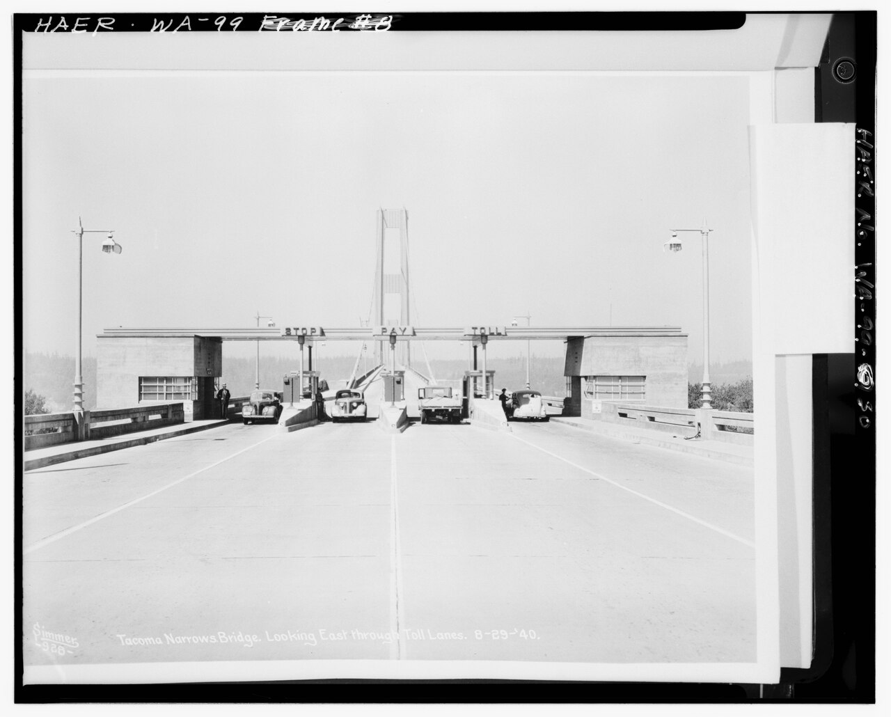
The toll lanes before the collapse
The view looks east through the toll lanes on August 29, 1940, when the bridge was less than two months old. The original photograph was reproduced in Clark Eldridge’s construction report and later copied into the Historic American Engineering Record. The later archive compilation date is not the date of the scene.
Photo details
Date
August 29, 1940
Location
Tacoma Narrows, Washington, United States
Photographer
Unknown original photographer; HAER archival reproduction
Unknown original photographer; HAER archival reproduction / Library of Congress, HAER WA-99, image 30. Public domain in the United States; NPS/HAER record
02 / 06
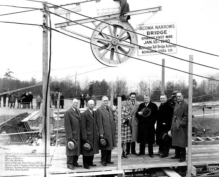
The first cable wire
Officials pose beside equipment marking the spinning of the bridge’s first wire on January 10, 1940. The sign supplies the occasion and date. This is a construction photograph, taken nearly ten months before the collapse.
Photo details
Date
January 10, 1940
Location
Tacoma Narrows, Washington, United States
Photographer
Unknown photographer
Archive / collection
University of Washington Libraries, Tacoma Narrows Bridge Collection, FAR103
Unknown photographer / University of Washington Libraries, Tacoma Narrows Bridge Collection, FAR103. No known copyright restrictions; University of Washington Libraries via Flickr Commons
03 / 06
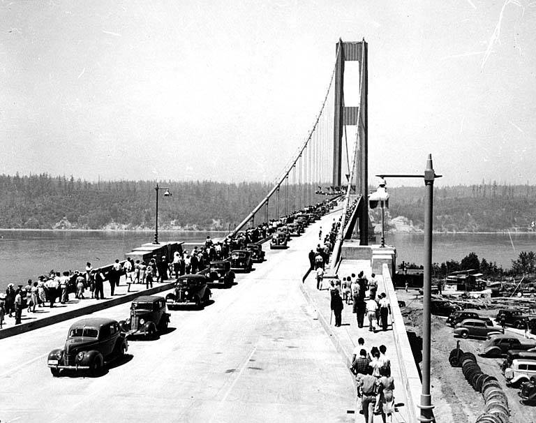
Cars and crowds on opening day
Traffic and pedestrians fill the new crossing on July 1, 1940. The long, narrow deck and suspension cables dominate the view. The photograph records the bridge’s opening, not the wind-driven motion that later made it famous.
Photo details
Date
July 1, 1940
Location
Tacoma Narrows, Washington, United States
Photographer
Unknown photographer
Archive / collection
University of Washington Libraries, Tacoma Narrows Bridge Collection, FAR008
Unknown photographer / University of Washington Libraries, Tacoma Narrows Bridge Collection, FAR008. No known copyright restrictions; University of Washington Libraries via Flickr Commons
04 / 06
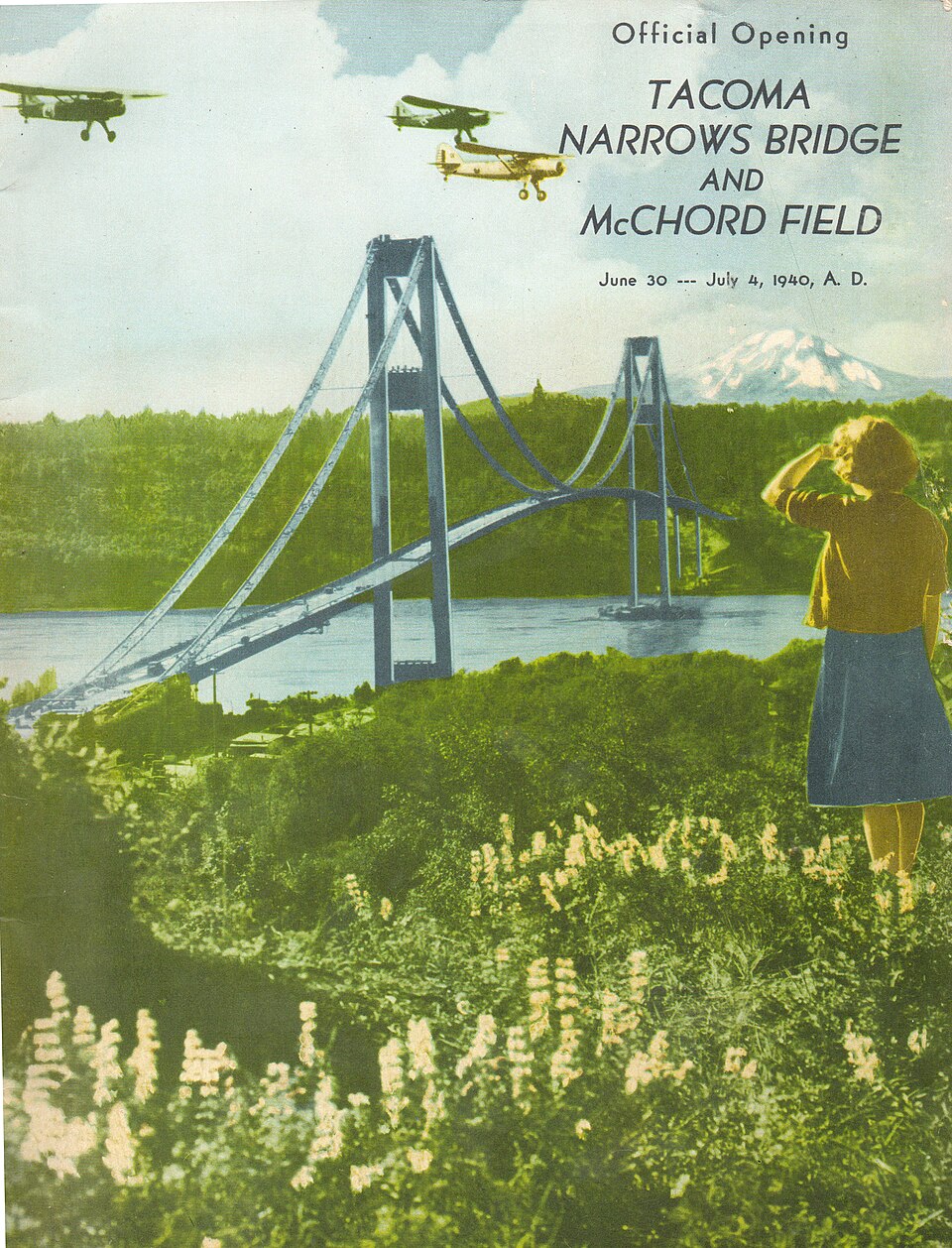
A printed promise of modern travel
The cover of the official celebration program pairs an illustrated suspension bridge with aircraft over McChord Field. The ceremonies ran from June 30 to July 4, 1940. This contemporary printed illustration records the civic celebration; it is not a photograph of the bridge.
Photo details
Date
June 30–July 4, 1940
Location
Tacoma Narrows, Washington, United States
Photographer
Tacoma Narrows Bridge–McChord Field Celebration Committee; prepared by Shannon Brothers; published by Johnson-Cox Company
Archive / collection
Collection of Wikimedia Commons contributor Centpacrr
Tacoma Narrows Bridge–McChord Field Celebration Committee; prepared by Shannon Brothers; published by Johnson-Cox Company / Collection of Wikimedia Commons contributor Centpacrr. Public domain in the United States; published without copyright notice
05 / 06
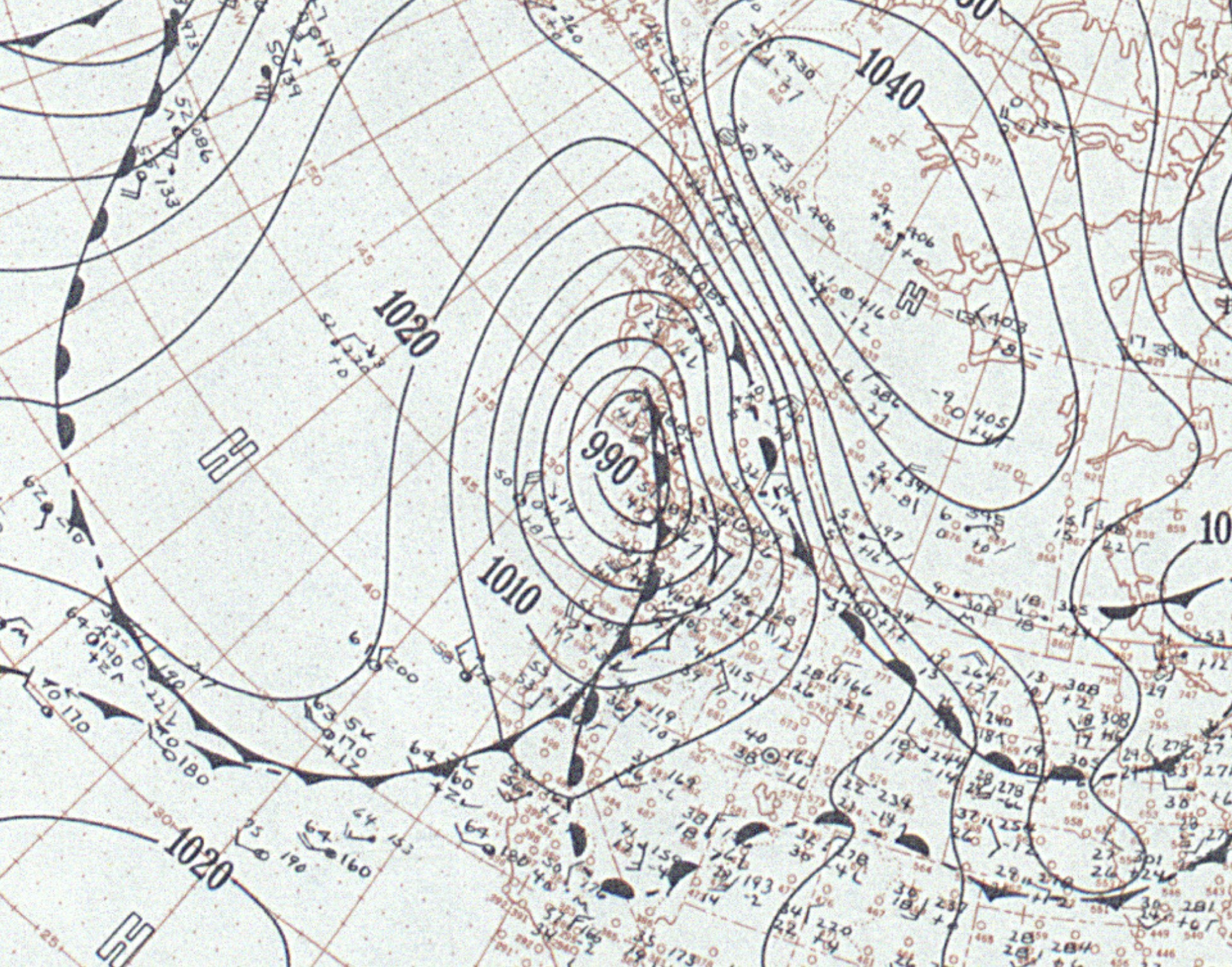
The weather on November 7
This U.S. Weather Bureau surface analysis records the pressure pattern on the day of the collapse. It supplies the wider meteorological setting. A weather map alone cannot explain the failure: the bridge’s twisting motion and the airflow around its deck were crucial.
U.S. Weather Bureau / NOAA Central Library historical weather maps. Public domain in the United States; U.S. government work
06 / 06
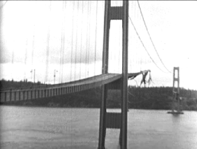
A frame from the actual collapse film
The roadway has broken away between the towers in this frame from film credited to Barney Elliot and preserved in the Stillman Fires Collection. It records November 7, 1940, rather than a later reconstruction. The modest resolution reflects the surviving published film still.