Ivy Mike was detonated at Enewetak Atoll on November 1, 1952, local time—October 31 in the continental United States. These six archival images move from the political decision and pre-test landscape to the fireball, cloud and crater. The photographs document an experiment; the captions also keep the displaced people of Enewetak in the story.
Topic: Cold War
01 / 06
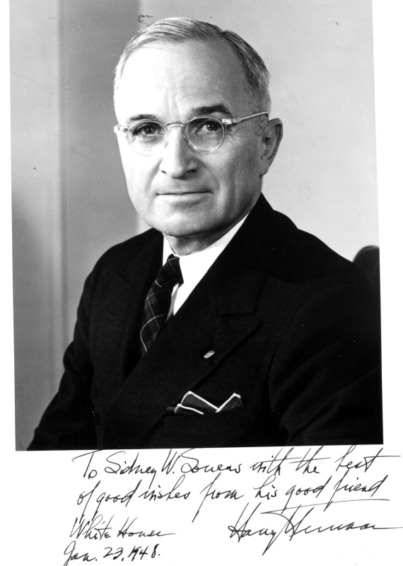
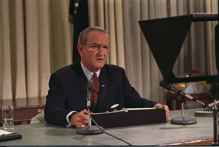
The president who authorized the program
This signed campaign portrait predates Truman’s January 1950 direction to pursue work on hydrogen weapons. It identifies the president whose decision moved the program forward; it is not an image of that announcement. The inscription belongs to January 1948, four years before the Pacific test.
Photo details
Date
January 23, 1948 (portrait inscription)
Location
United States; studio location not specified
Photographer
Frank Gatteri, U.S. Army Signal Corps
Archive / collection
Harry S. Truman Library & Museum, 96-984
Rights / license
Public domain in the United States; official United States government photograph, as identified by the holding archive or archive copy.
Frank Gatteri, U.S. Army Signal Corps / Harry S. Truman Library & Museum, 96-984; public domain.
02 / 06
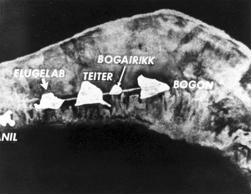
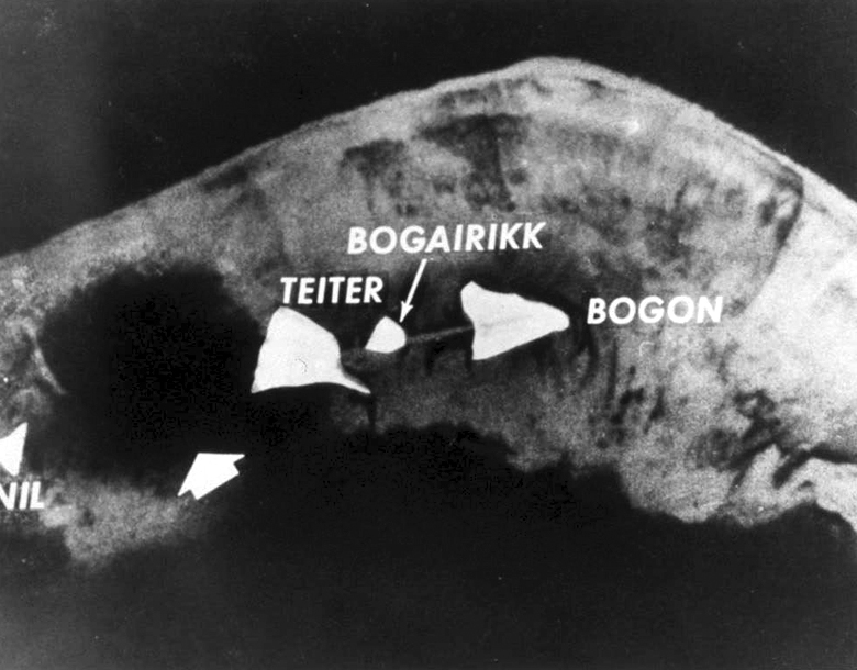
Elugelab before the test
The labeled aerial photograph locates Elugelab among neighboring islands before Mike. The atoll’s inhabitants had already been relocated to Ujelang. What looks like a set of small shapes on a military photograph was part of a lived landscape. The final image in this gallery records the same area after the explosion.
Photo details
Date
1952, before the Mike detonation
Location
Enewetak Atoll, Marshall Islands
Photographer
United States government photographer; individual unidentified
Archive / collection
U.S. government photograph, reproduced in the Chuck Hansen archive and on Wikimedia Commons
Rights / license
Public domain in the United States; official United States government photograph, as identified by the holding archive or archive copy.
United States government photographer; individual unidentified / U.S. government photograph, reproduced in the Chuck Hansen archive and on Wikimedia Commons; public domain.
03 / 06
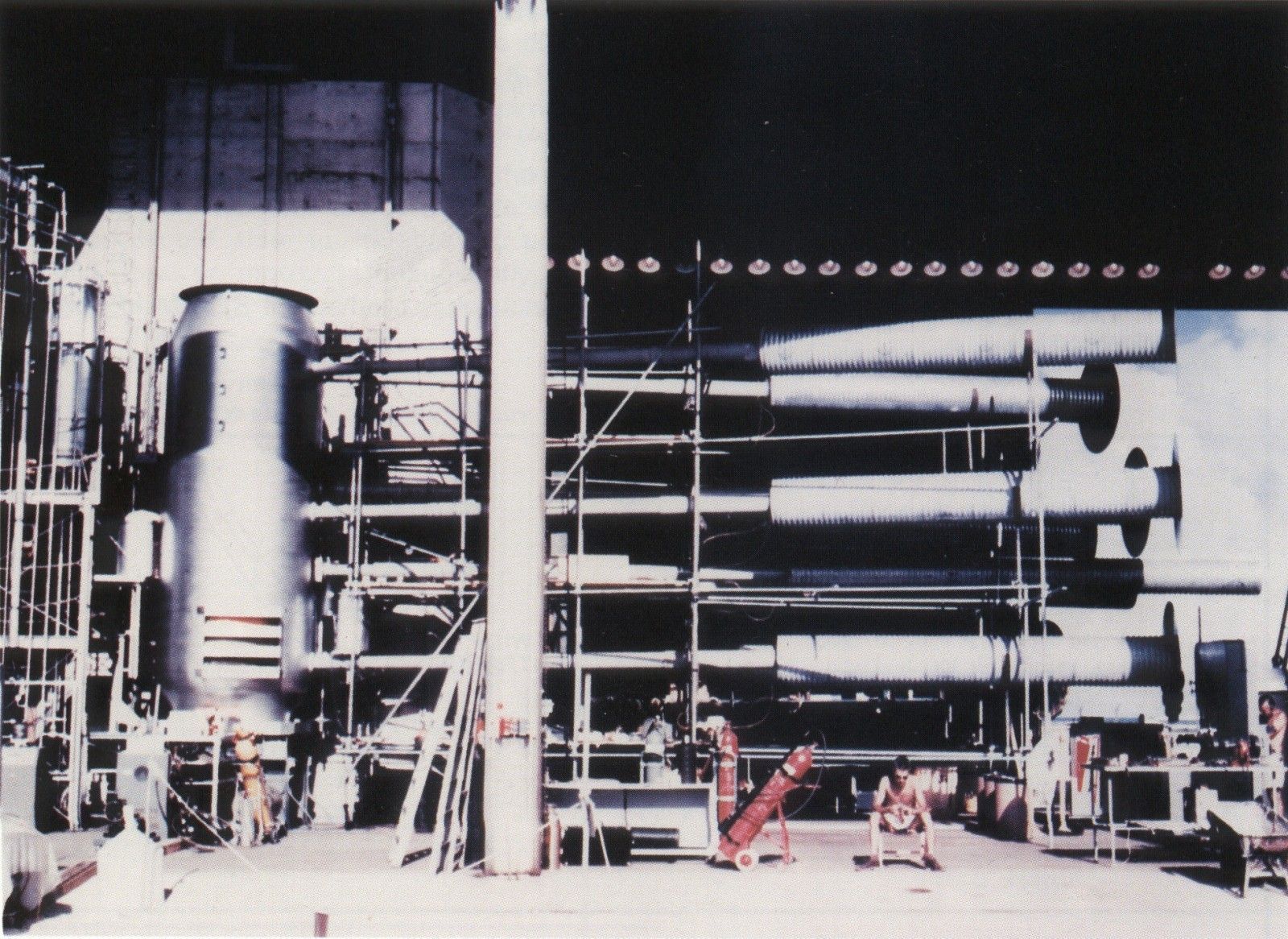
An experiment built like an installation
The Mike installation required a substantial building and supporting equipment. Its scale helps explain why the successful test did not immediately provide a compact operational bomb. This archival view records the experimental apparatus before detonation; it is included as a historical photograph, without treating the machinery as a construction diagram.
Photo details
Date
1952, before November 1
Location
Elugelab, Enewetak Atoll, Marshall Islands
Photographer
United States Atomic Energy Commission
Archive / collection
Department of Energy predecessor-agency photograph, via Wikimedia Commons
Rights / license
Public domain in the United States; official United States government photograph, as identified by the holding archive or archive copy.
United States Atomic Energy Commission / Department of Energy predecessor-agency photograph, via Wikimedia Commons; public domain.
04 / 06
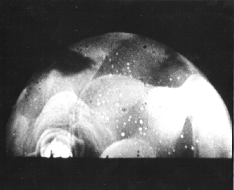
The camera catches the beginning
A high-speed photograph catches the early fireball. The image belongs to the scientific recording of the test, when cameras could reveal stages too brief for an observer to distinguish. Its archive date is often October 31 because of the time difference; the explosion took place on November 1 at Enewetak.
Photo details
Date
November 1, 1952, local time (October 31 in U.S. records)
Location
Enewetak Atoll, Marshall Islands
Photographer
Charles Wyckoff, as credited in the archive copy
Archive / collection
National Nuclear Security Administration, Nevada Site Office Photo Library, IVY-52-07
Rights / license
Public domain in the United States; official United States government photograph, as identified by the holding archive or archive copy.
Charles Wyckoff, as credited in the archive copy / National Nuclear Security Administration, Nevada Site Office Photo Library, IVY-52-07; public domain.
05 / 06
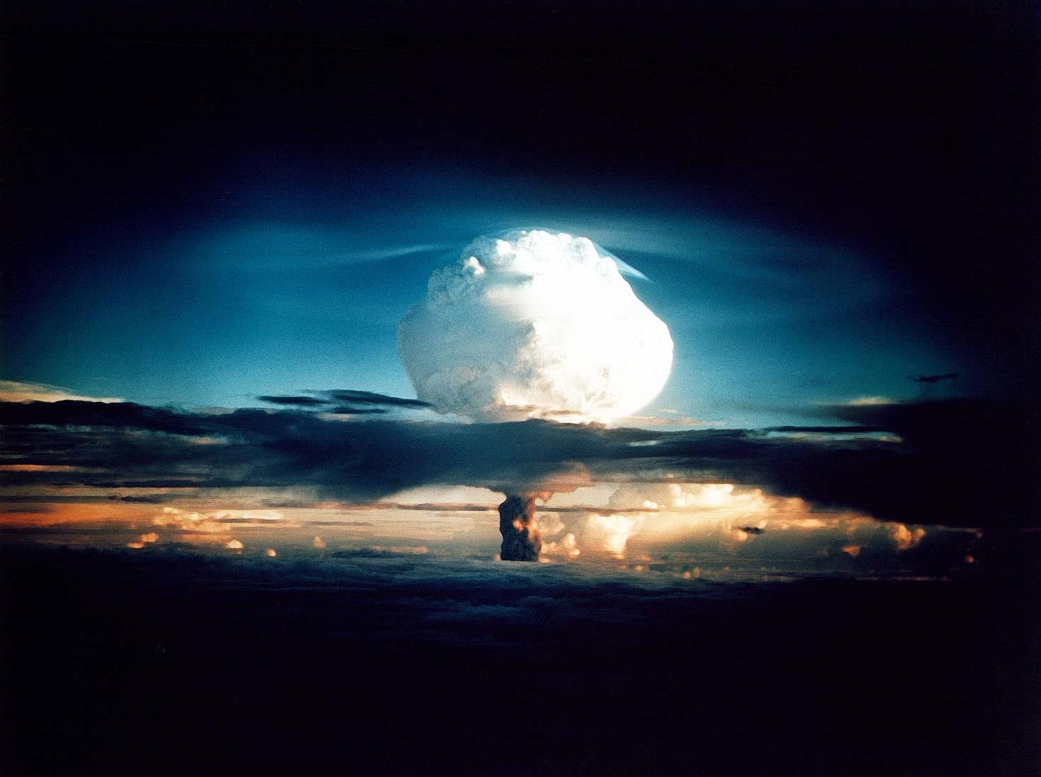
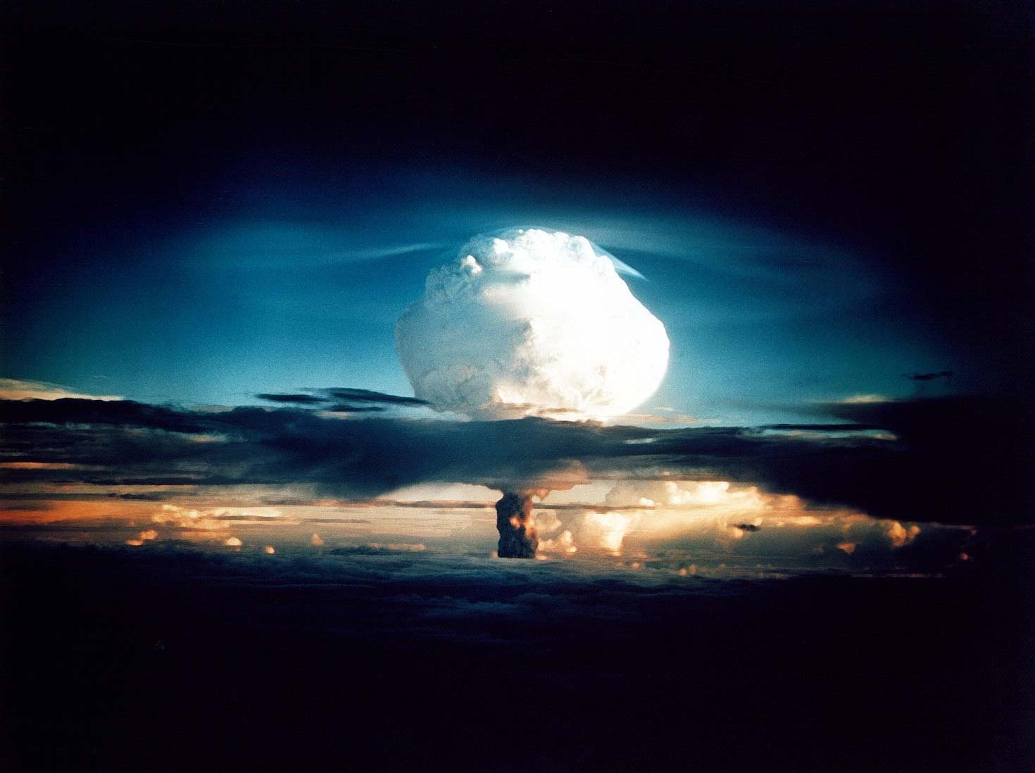
The cloud that became the public image
The Mike cloud rises above the Pacific after the 10.4-megaton test. This color photograph became one of the best-known images of thermonuclear testing. The distant view gives the cloud a clear outline while concealing what happened at ground level: the destruction of Elugelab and the contamination left across the testing landscape.
Photo details
Date
November 1, 1952, local time
Location
Enewetak Atoll, Marshall Islands
Photographer
United States government photographer; individual unidentified
Archive / collection
National Nuclear Security Administration, Nevada Site Office Photo Library, XX-11
Rights / license
Public domain in the United States; official United States government photograph, as identified by the holding archive or archive copy.
United States government photographer; individual unidentified / National Nuclear Security Administration, Nevada Site Office Photo Library, XX-11; public domain.
06 / 06
Where an island had been
A dark circular crater occupies the place where Elugelab appeared in the pre-test view. The surrounding islands provide a way to compare the two photographs. This is the lasting geographical change behind the spectacular cloud: an island removed from the atoll, within a testing program whose consequences continued long after 1952.
Photo details
Date
1952, after the Mike detonation; exact photograph date not recorded
Location
Enewetak Atoll, Marshall Islands
Photographer
United States government photographer; individual unidentified
Archive / collection
U.S. government photograph, reproduced in the Chuck Hansen archive and on Wikimedia Commons
Rights / license
Public domain in the United States; official United States government photograph, as identified by the holding archive or archive copy.
United States government photographer; individual unidentified / U.S. government photograph, reproduced in the Chuck Hansen archive and on Wikimedia Commons; public domain.