North and South Dakota entered the Union together on November 2, 1889. The transition was prepared in convention halls and celebrated in public streets. It also took place amid expansion of settler government and the loss of Indigenous land.
This gallery brings together five photographs and one historical map. The convention parade belongs to 1889; the other records provide context before and after admission, with their individual dates retained.
Topic: American History
01 / 06
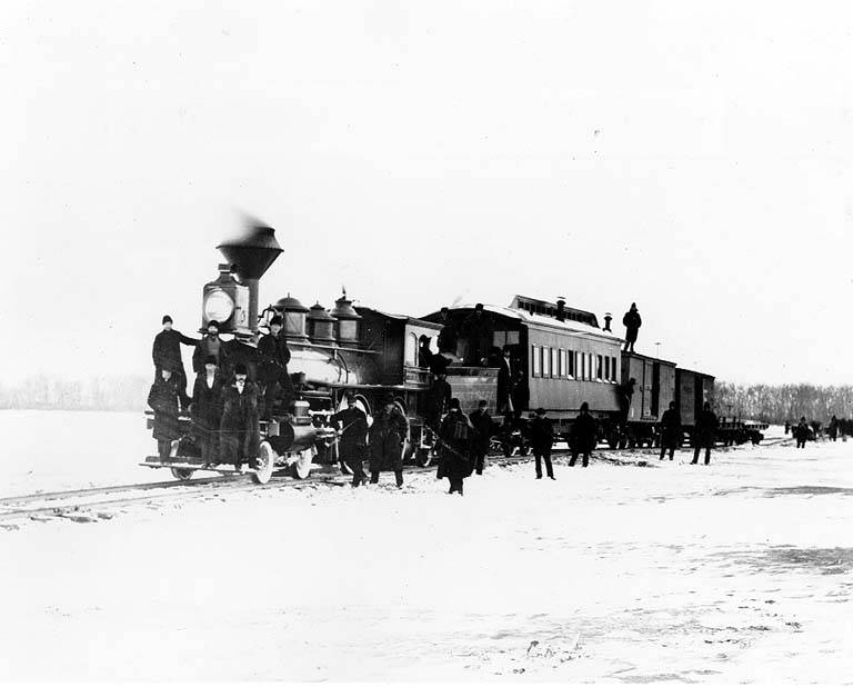
A railway crosses the frozen Missouri
Before a permanent bridge carried trains across the Missouri at Bismarck, seasonal crossings could depend on ice. The original photograph is dated March 1879. Rail links helped shape the movement of people and goods that changed Dakota’s economy during the decade before statehood.
Photo details
Date
March 1879
Location
Near Bismarck, Dakota Territory
Photographer
Photographer unidentified
Archive / collection
University of Washington Special Collections, Transportation Photographs, TRA0207
Rights / license
Public domain; historical U.S. work with expired copyright
Photographer unidentified / University of Washington Special Collections, Transportation Photographs, TRA0207
02 / 06
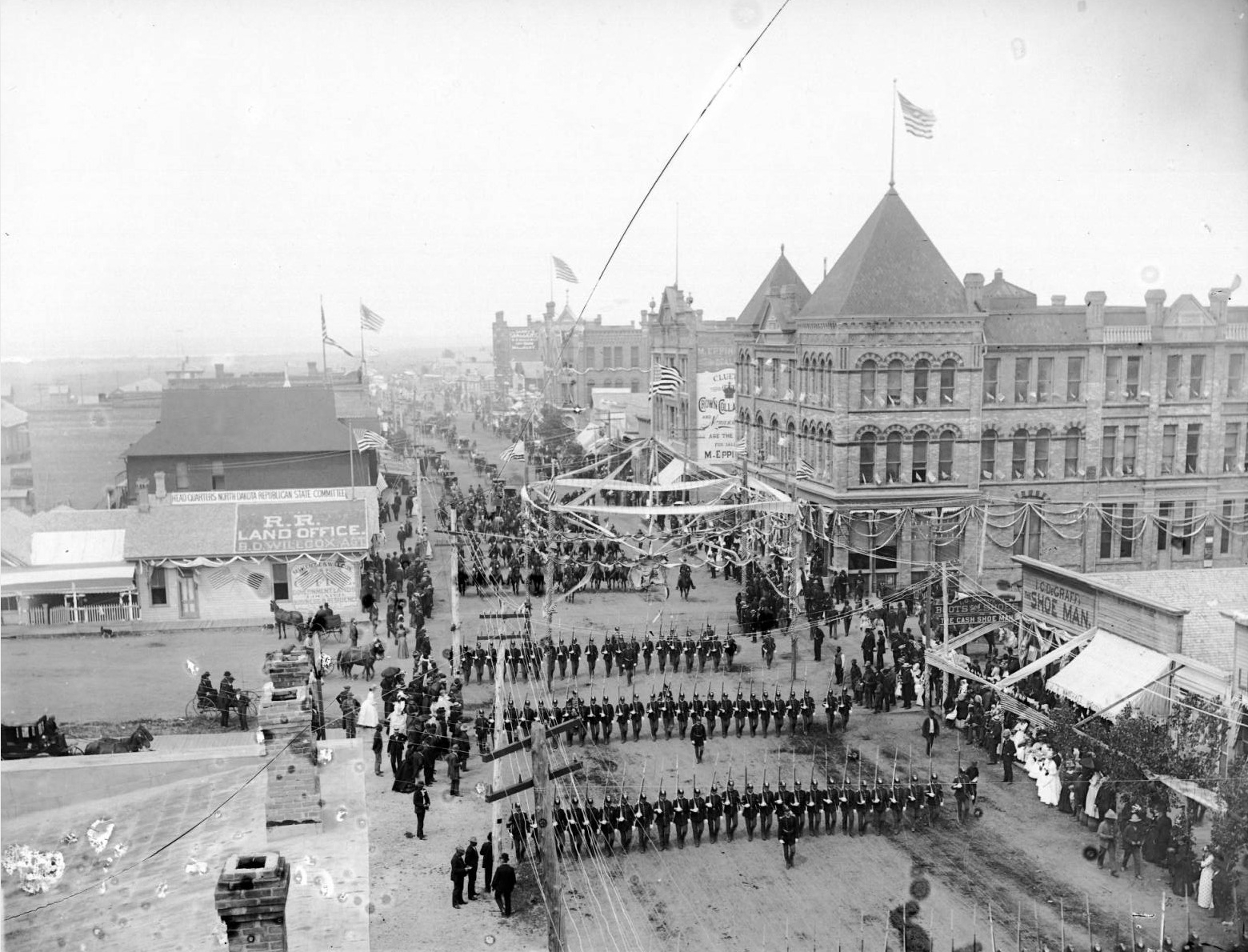
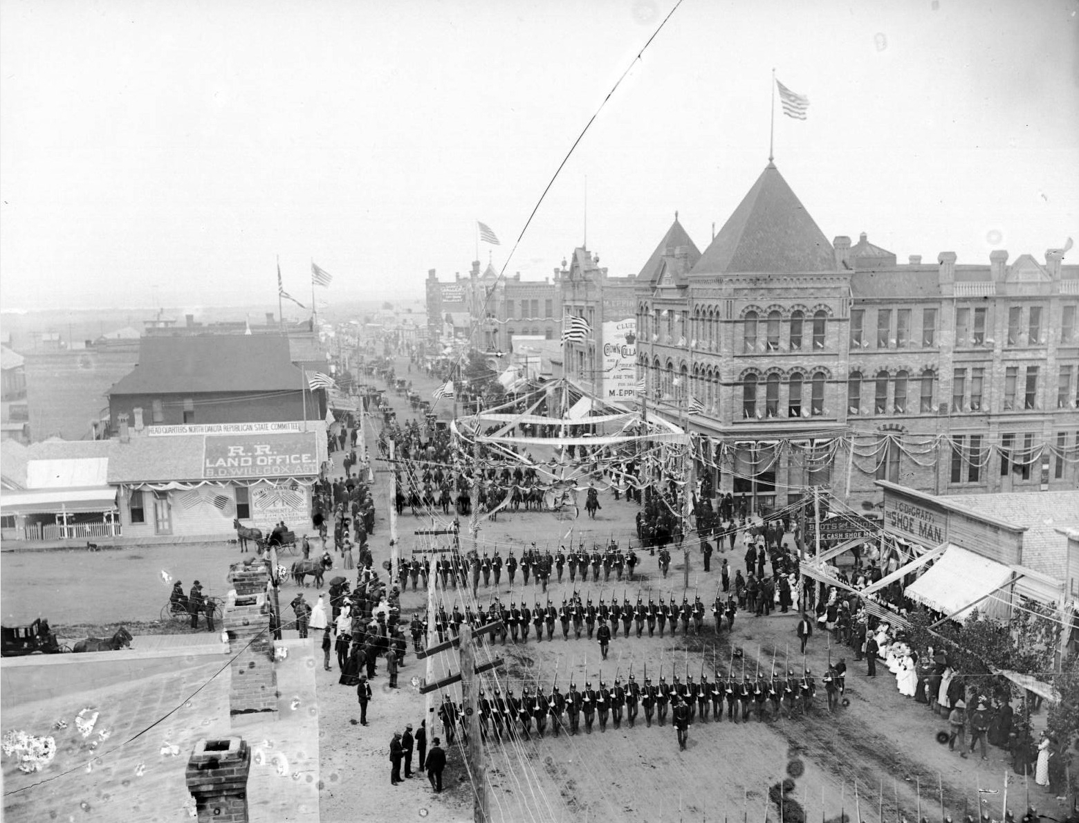
Bismarck celebrates the constitutional convention
David Francis Barry recorded a constitutional-convention parade at Main and Fourth streets in 1889. The parade belonged to the process of forming the new state, before the admission proclamation of November 2. Flags and ranks of marchers show the public ceremony surrounding what was also detailed legal and political work.
Photo details
Date
1889; exact day not established in this record
Location
Bismarck, Dakota Territory
Photographer
David Francis Barry
Archive / collection
Denver Public Library Digital Collections
Rights / license
Public domain; historical U.S. work with expired copyright
David Francis Barry / Denver Public Library Digital Collections
03 / 06
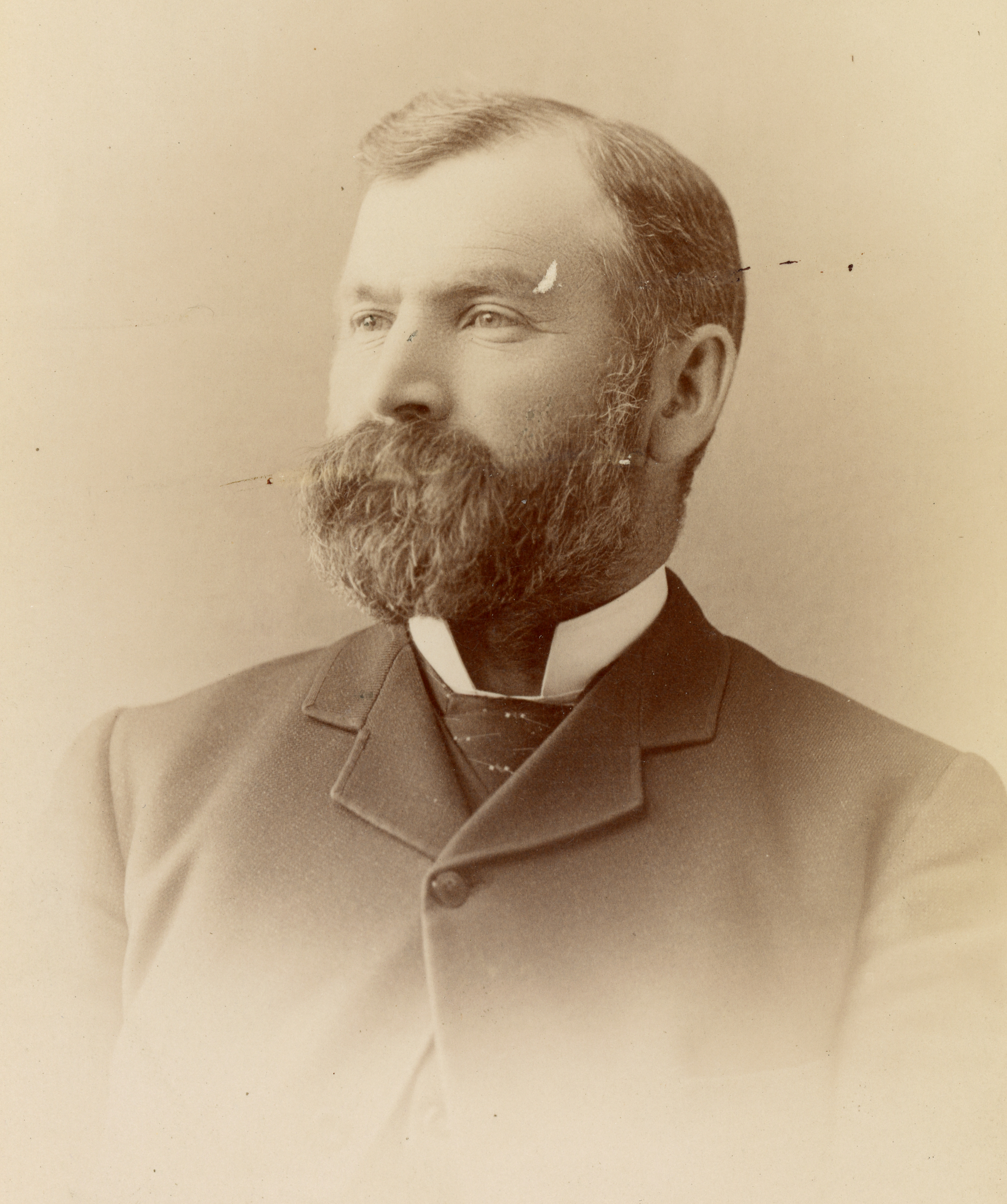
North Dakota’s first governor
John Miller appears in a studio portrait dated by the archive to the late 1880s. His administration began with arguments over policy, including prohibition and lotteries. The shift from territory to state did not remove the divisions among farmers, business interests and party leaders.
Photo details
Date
Between 1886 and 1889
Location
United States; studio location not established here
Photographer
Photographer unidentified
Archive / collection
North Dakota State Library, North Dakota Memories Collection
Rights / license
Public domain; historical U.S. work with expired copyright
Photographer unidentified / North Dakota State Library, North Dakota Memories Collection
04 / 06
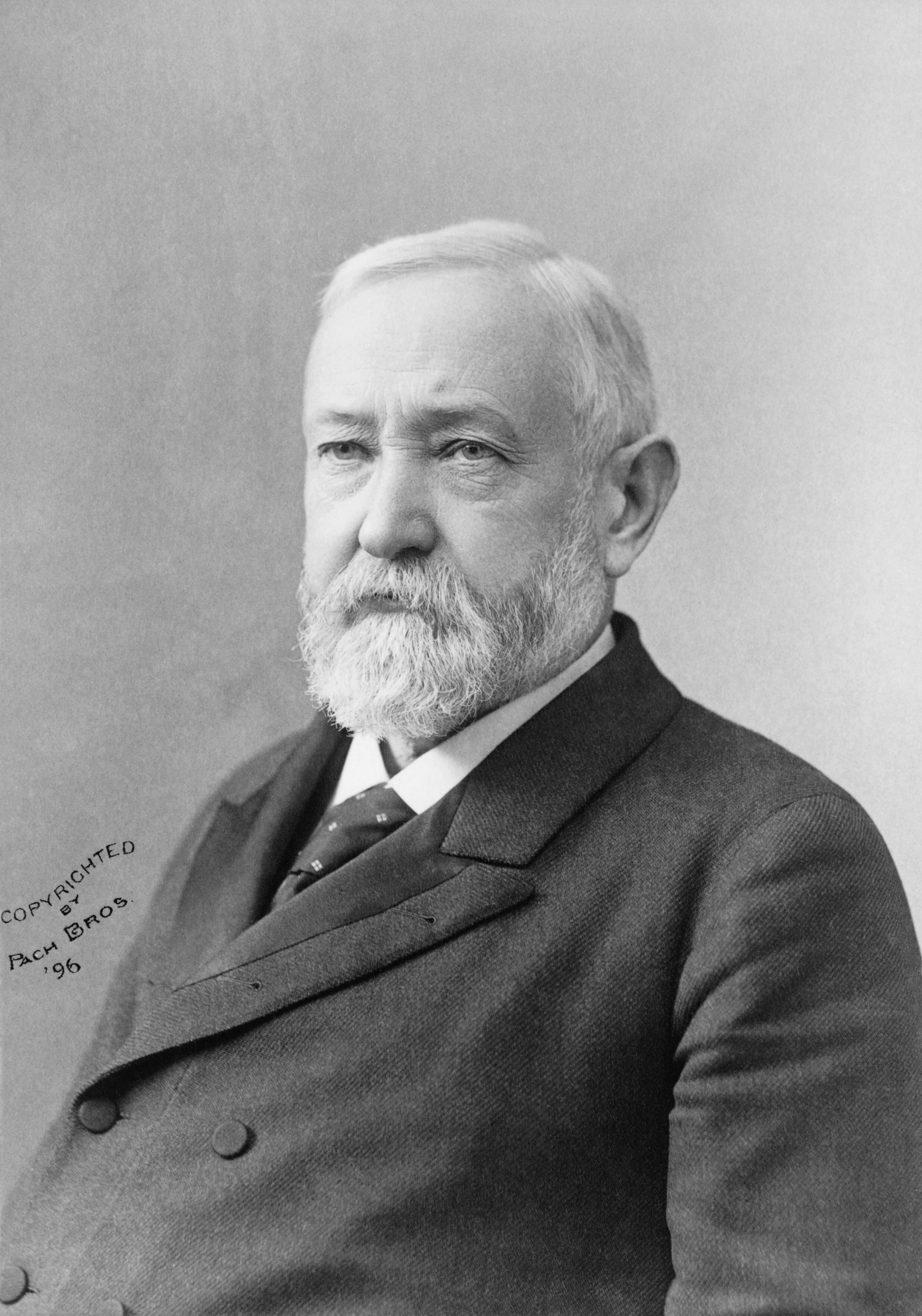
The president who signed both proclamations
This Pach Brothers portrait was made in 1896, seven years after the two admissions. Harrison’s role on November 2 was to issue the proclamations completing the federal process. His effort to conceal their signing order is why the familiar thirty-ninth and fortieth labels do not establish which document was signed first.
Photo details
Date
1896
Location
United States
Photographer
Pach Brothers; restoration by Adam Cuerden
Archive / collection
Library of Congress, cph.3c34885; Wikimedia Commons
Rights / license
Public-domain original; restoration released for unrestricted use by Adam Cuerden
Pach Brothers; restoration by Adam Cuerden / Library of Congress, cph.3c34885; Wikimedia Commons
05 / 06
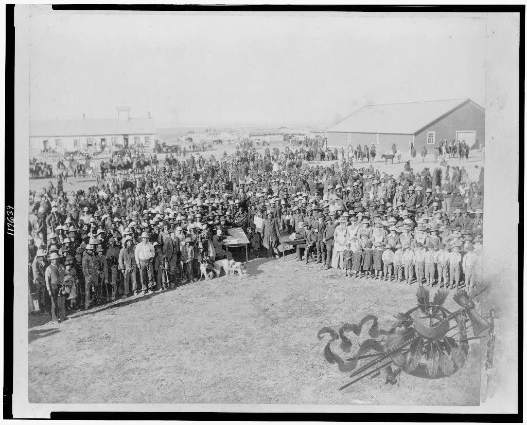
People within the reservation system
Barry’s photograph records census-taking at Standing Rock Agency. The Library of Congress dates the scene broadly between 1880 and 1900; it is not assigned to statehood day. It places Indigenous people and federal administration within the visual history of the region, alongside the parades and portraits of elected officials.
Photo details
Date
Between 1880 and 1900
Location
Standing Rock Agency, Dakotas
Photographer
David Francis Barry
Archive / collection
Library of Congress, cph.3c17639
Rights / license
Public domain; Library of Congress records no known restrictions on publication
David Francis Barry / Library of Congress, cph.3c17639
06 / 06
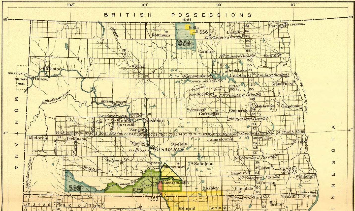
The land history beneath state boundaries
Published in 1899, this federal map looks back at Indigenous land boundaries and cessions in North Dakota. It is a later historical compilation, not a map issued for the November 1889 ceremony. Such records help explain why a state border alone cannot describe the region’s political geography.
Photo details
Date
1899 publication; depicts earlier land boundaries
Location
North Dakota, United States
Photographer
U.S. Bureau of American Ethnology / Government Printing Office
Archive / collection
Smithsonian Institution, Eighteenth Annual Report, Part 2
Rights / license
Public domain in the United States; official federal government work